| Home Page |
| GB3FM |
| GB3FN |
| GB3FX |
| GB3SN |
| GB3FNM Beacons |
| Coverage |
| The Group |
| Supporters |
| Constitution |
| How to Join |
| Help Us ! |
| Radio Links |
| Site Tour |
| Contact Us |
GB3FM - GB3FN - GB3FX - GB3SN
Coverage
Maps
Coverage maps are always dependent on the parameters of the mobile. A 25W mobile with a high gain antenna will usually provide better coverage than a 5W mobile with a low gain antenna. The siting of the antenna on the vehicle can cause markedly different propagation in different directions. This is more pronounced at 50MHz than at 433MHz as the groundplane on 433MHz doesn't need to be so big to be effective (by a factor of nearly ten).
Finally, a lot depends on the perception of the users. Some users will give up using the repeater as soon as its signal falls off the end stop of the signal meter, and don't like any flutter. Others will carry on to the bitter end and try and get service if it's just above squelch. The coverage maps here are closer to the latter, i.e. coverage is shown as present if it is usable but weak.
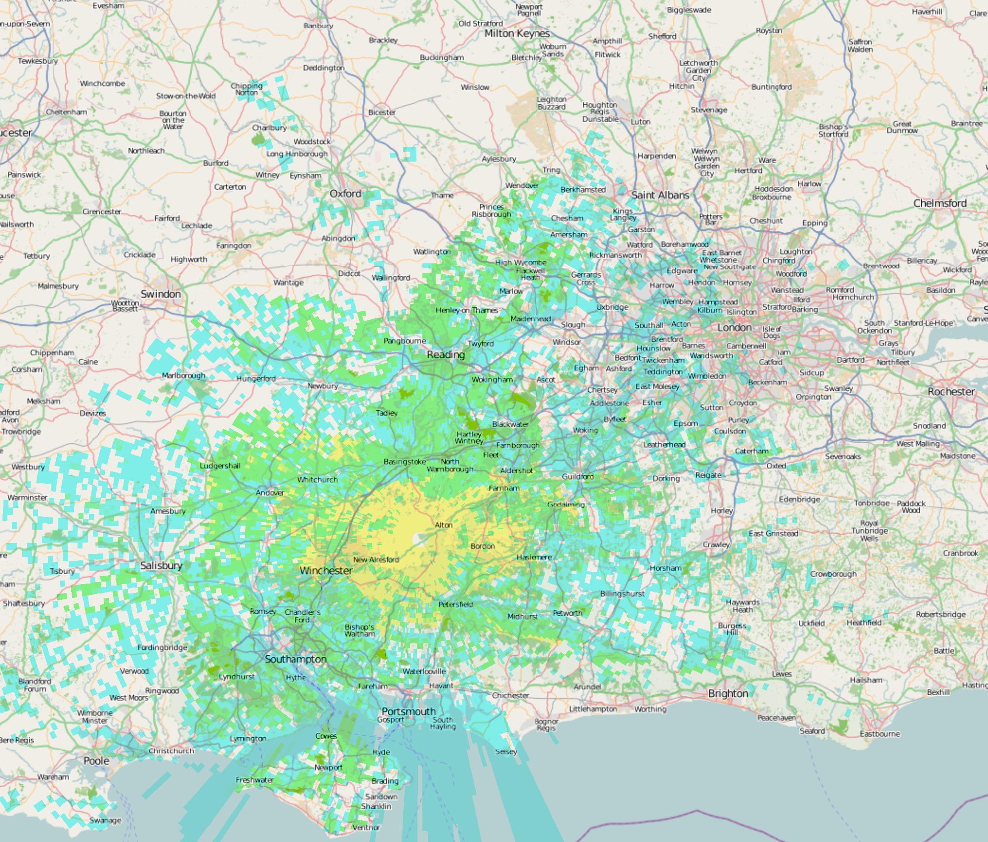
GB3FN
The map has been plotted using the
rather excellent
Radio Mobile program from VE2DBE. It shows expected mobile
coverage.
Yellow is a strong signal
Green is a good signal
Blue is marginal coverage
Whether blue coloured areas are in coverage or not will depend on
the
mobile installation and on the preference of the operator to
listen to
weak signals. Portables should have coverage over most of
the
yellow area, but may need to pick the right spot to stand.
Note: Diagonal lines on some areas of the map indicate MoD
property and are not relevant to the coverage prediction.
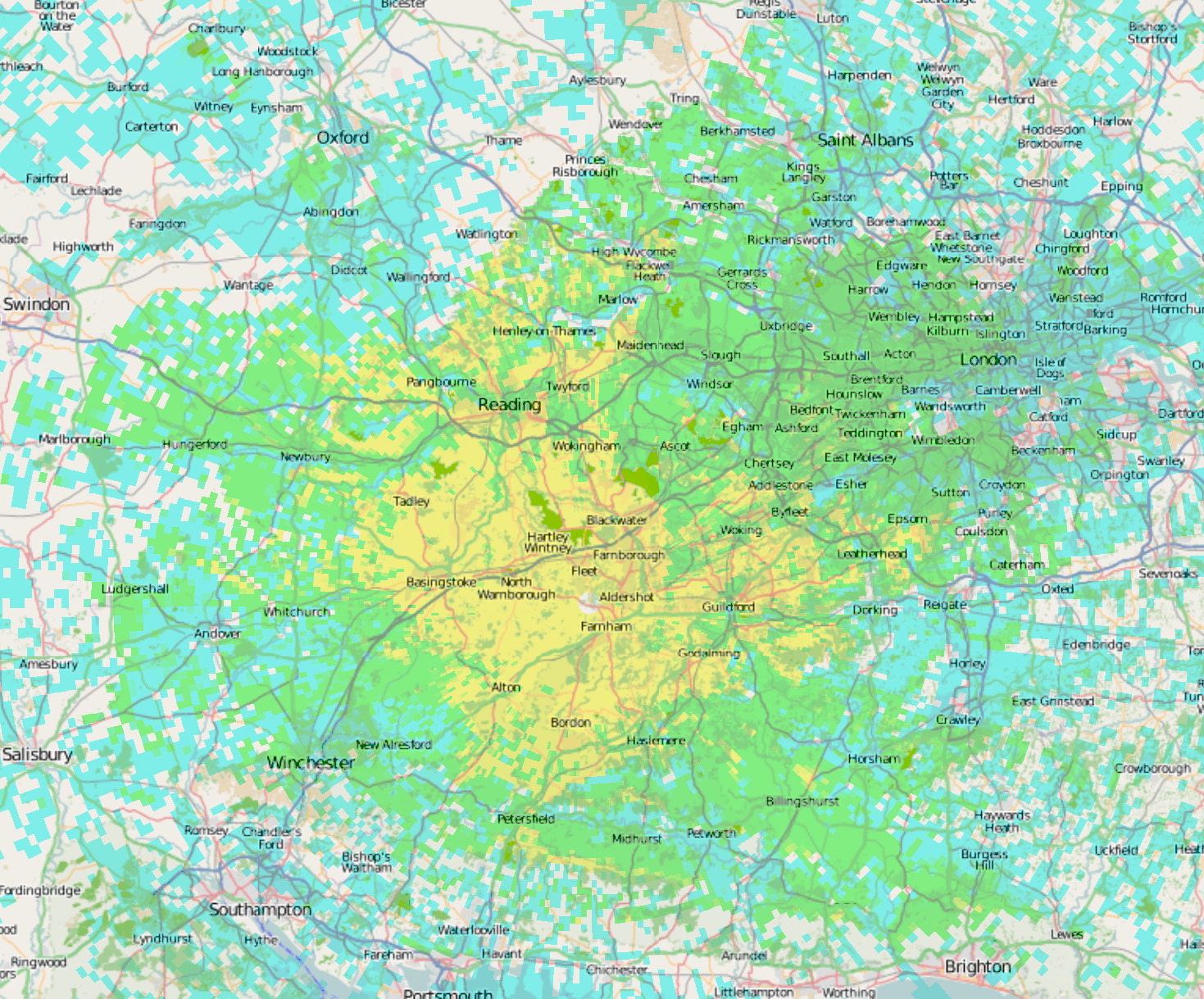
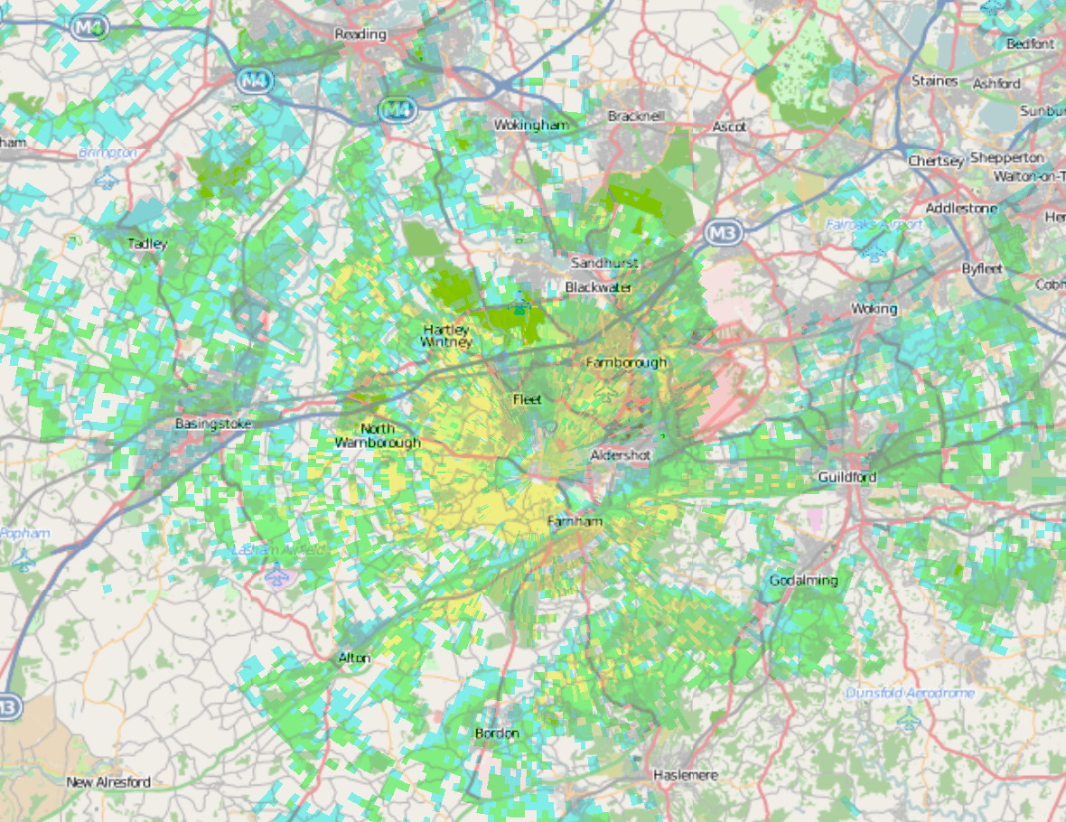
GB3FX
As with GB3FN, the map has been plotted using the rather excellent Radio Mobile program from VE2DBE. It shows expected mobile coverage, with some dependency on local conditions and the abilities of the mobile installation.
Yellow shows a strong signal, and this area should be
workable for most mobiles.
Green should still be workable for most mobiles unless the
installation uses a short antenna, and unless there are local
obstructions or noise sources.
Blue shows marginal coverage, where mobiles in relatively
unobstructed conditions may be able to use the repeater, depending
on the tolerance of the operator to noise.
Varying antenna efficiency and background noise on 50MHz make the map a little less predictable than at higher frequencies. (Diesel engined cars without CD players do better than petrol engined cars with the CD going - 'FX's output seems to be close to a harmonic of a crystal used universally in CD players!) Many mobiles will achieve somewhere between the two - depending on which direction they are pointing in and so which direction their antenna works best in.
Some indications on how far the 'regulars' running up to 50W and quarter wave antennas have worked GB3FX:
M1 North - Luton
M40 West - North of Oxford
M40 East - as far as it goes
M4 West - Membury, but note it reappears cross country Cirencester
to Birdlip.
M4 East - as far as it goes
M25 North - the A1M
M25 East - beyond the M23. Also from the Dartford river
crossing.
M23 South - Crawley and Gatwick airport
M3 North - as far as it goes
M3 South - Winchester
M27 Short stretches between Portsmouth and Southampton
A303 West - Salisbury Plain
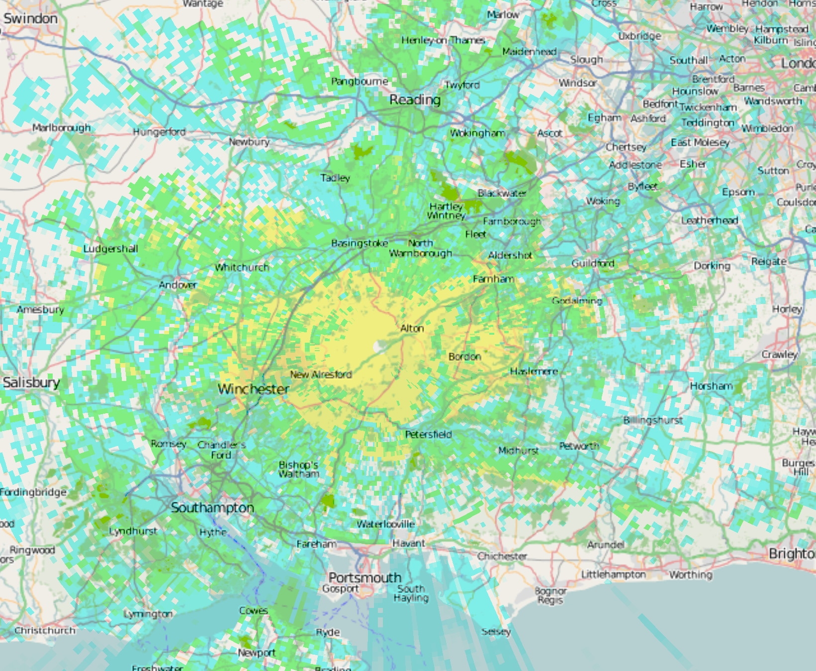
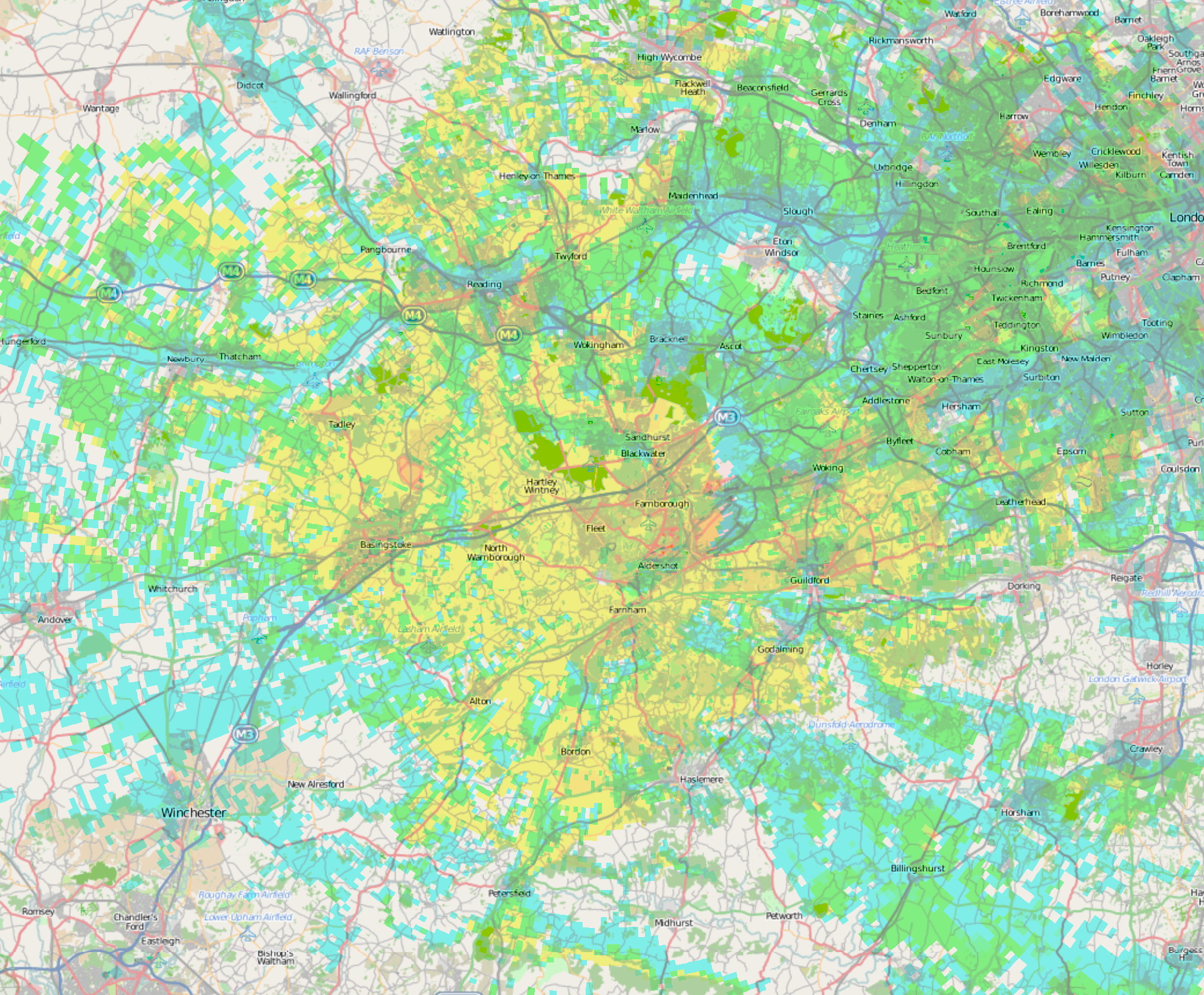
GB3SN
This map has also been plotted using the rather excellent Radio Mobile program from VE2DBE. It shows expected mobile coverage, with some dependency on local conditions and the abilities of the mobile installation.Yellow shows a strong signal, and this area should be workable for most mobiles.
Green should still be workable for most mobiles unless the installation uses a less effective antenna (e.g. quarter wave not on the roof), and unless there are local obstructions or noise sources.
Blue shows marginal coverage, where mobiles in relatively unobstructed conditions and with good aerials may be able to use the repeater, depending on the tolerance of the operator to noise.
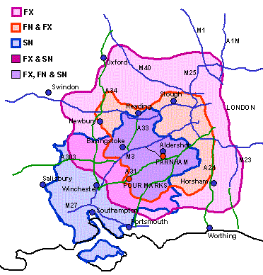
Coverage Maps
Click on an image or the associated text for a full size map.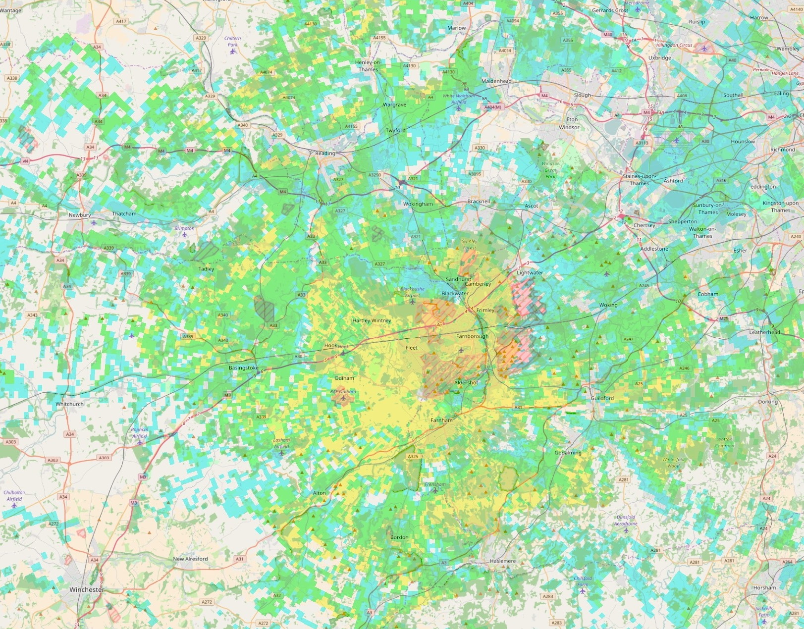
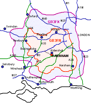
Three repeaters
This graphic gives a general local coverage
indication and includes GB3SN on 2m.
GB3FM
Coverage predictions are likely to be more approximate at 23cm than for our other repeaters.There are two maps plotted:
GB3FM mobile - whereas 23cm mobiles are few and far between, this gives an idea of where the repeater might be heard. The repeater should be audible over the yellow area with a simple setup, such as a portable inside a car (perhaps on the dashboard). The green and blue areas will probably need an external antenna, such as an Alford slot on top of the car; the blue area probably audible only when there are not local obstructions near the mobile.
GB3FM fixed - this is intended to give an idea where a fixed station with an outside aerial may be able to hear the repeater. The yellow area has a good probability of success and the green area should also be achievable for a fixed station with a reasonable aerial without too much local obstruction. The blue area may still be good to receive the repeater, but is likely to need a good aerial and possibly some careful location of the aerial to avoid local obstructions.
| Top of Page | Home Page |